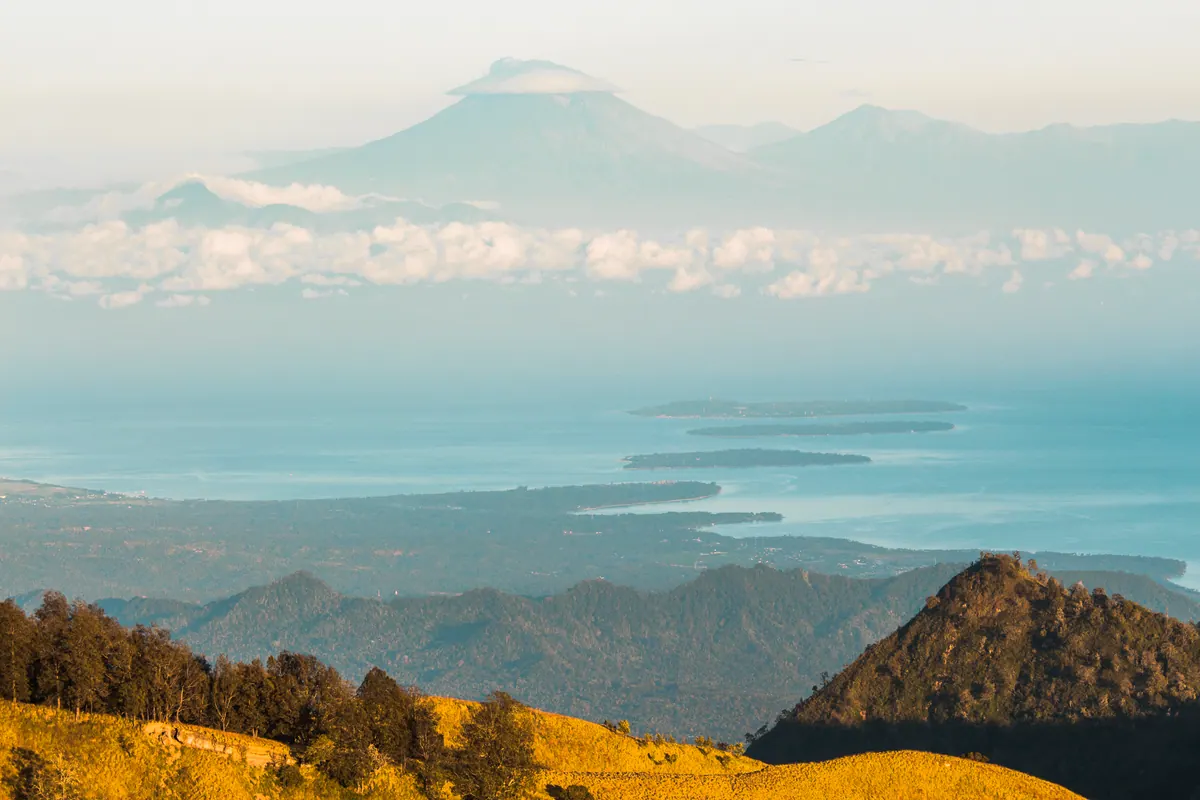
The Senaru Trekking Route is one of the most scenic hiking trails on Mount Rinjani, Lombok, Indonesia. Starting from the traditional mountain village of Senaru, this route takes trekkers through tropical rainforest, steep mountain trails, and open ridges before reaching the spectacular Senaru Crater Rim.
At Rinjani Volcano by Jou Trekking, we offer guided Mount Rinjani adventures for travelers who want to discover the natural beauty of the volcano while experiencing the mountain with local trekking guides.
Senaru Trekking Route Overview
The Senaru route approaches Mount Rinjani from the northern side of the national park. It is particularly popular with travelers who want to experience the volcanic landscape without climbing to the main summit.
Route Information
- Starting Point: Senaru Village, North Lombok
- Starting Elevation: Approximately 600 meters above sea level
- Main Destination: Senaru Crater Rim (approximately 2,641 meters)
- Trail Conditions: Tropical rainforest, mountain paths, grassland, and steep rocky sections
- Difficulty: Moderate to challenging
- Popular Trekking Duration: 2 Days 1 Night
- Main Attractions: Segara Anak Lake, Mount Barujari, rainforest, and panoramic crater views
What to Expect on the Senaru Trekking Route
1. Starting the Trek from Senaru Village
The adventure begins in Senaru, a mountain village located on the northern slopes of Mount Rinjani.
After registration and preparation, trekkers begin walking through the lower forest, where tall tropical trees provide shade along much of the trail.
The first section introduces visitors to the natural environment of Mount Rinjani National Park.
2. Hiking Through the Tropical Rainforest
One of the most distinctive features of the Senaru route is its rainforest.
Unlike the open grasslands of the Sembalun route, much of the Senaru ascent passes through dense vegetation.
Trekkers may encounter tropical birds, long-tailed macaques, and other wildlife along the trail.
The forest provides welcome shade, although the continuous uphill sections can still be physically demanding.
3. From the Forest to the Mountain Ridge
As the trail climbs higher, the rainforest gradually gives way to more open terrain.
The final ascent toward the crater rim becomes steeper, with rocky paths and exposed sections requiring careful footing.
During clear weather, the surrounding mountain landscape becomes increasingly visible.
4. Arriving at Senaru Crater Rim
Reaching the Senaru Crater Rim is the highlight of the journey.
From approximately 2,641 meters above sea level, trekkers can enjoy sweeping views across the volcanic caldera.
The scenery includes Segara Anak Lake, Mount Barujari, and the surrounding mountain ridges.
On clear evenings, the crater rim offers beautiful sunset views. Early mornings can also provide excellent opportunities for photography before clouds develop around the mountain.
Highlights of the Senaru Trekking Route
Segara Anak Lake
Segara Anak is a volcanic crater lake situated within Mount Rinjani's enormous caldera. Its blue waters create a striking contrast with the rugged volcanic landscape.
From the Senaru Crater Rim, visitors can admire the lake from above without descending to its shoreline.
Mount Barujari Volcano
Mount Barujari is the volcanic cone located inside Mount Rinjani's caldera.
Its distinctive shape makes it one of the most recognizable features of the landscape.
Tropical Rainforest
The Senaru rainforest provides a different trekking experience from the more exposed Sembalun route.
Its towering trees, dense vegetation, and mountain wildlife make the ascent particularly appealing to nature lovers.
Sunset and Sunrise
The crater rim offers excellent opportunities to watch the changing colors of the mountain landscape.
Visibility depends on weather conditions, and clear views cannot be guaranteed.
Is the Senaru Trekking Route Difficult?
The Senaru Trekking Route is considered moderate to challenging.
Although it does not require technical climbing equipment under normal trekking conditions, the long uphill sections demand reasonable physical fitness.
The trail can become slippery during or after rainfall, particularly in the forest.
Trekkers should wear suitable hiking shoes, carry sufficient drinking water, and prepare for changing mountain weather.
Senaru Route vs Sembalun Route
Both routes provide memorable experiences, but they offer different landscapes and trekking objectives.
Senaru Route
- Starts from the northern side of Mount Rinjani
- Passes through tropical rainforest
- Offers impressive views of Segara Anak Lake
- Popular for overnight crater rim trekking
- Suitable for travelers who do not plan to reach the main summit
Sembalun Route
- Starts from the eastern side of Mount Rinjani
- Features open hills and grassland
- Commonly used for Mount Rinjani summit expeditions
- Provides access to the main summit trail
- Suitable for trekkers seeking a more demanding summit adventure
Best Time to Trek the Senaru Route
The drier months generally provide more favorable trekking conditions on Mount Rinjani.
However, weather in the mountains can change quickly, and rain, strong winds, or clouds may occur even during the dry season.
Trekking access is subject to Mount Rinjani National Park regulations, seasonal closures, and current trail conditions.
Always confirm official route availability before arranging your trip.
Explore the Senaru Route with Rinjani Volcano
At Rinjani Volcano by Jou Trekking, we specialize in guided Mount Rinjani trekking experiences in Lombok.
Our small-group approach allows trekkers to enjoy a more personal mountain experience, with a maximum of four participants per group.
For travelers interested in exploring the Senaru route, our 2 Days 1 Night Senaru Crater Rim Trek offers an opportunity to experience the rainforest, mountain scenery, and spectacular volcanic caldera.
Whether you are visiting Mount Rinjani for the first time or returning to discover a different side of the volcano, the Senaru Trekking Route offers a rewarding adventure.
Discover Mount Rinjani with Jou Trekking and experience the beauty of Lombok volcanic landscape.